Mapping & GPS Tools for Remote Hunts in Canada: Complete Guide by Province
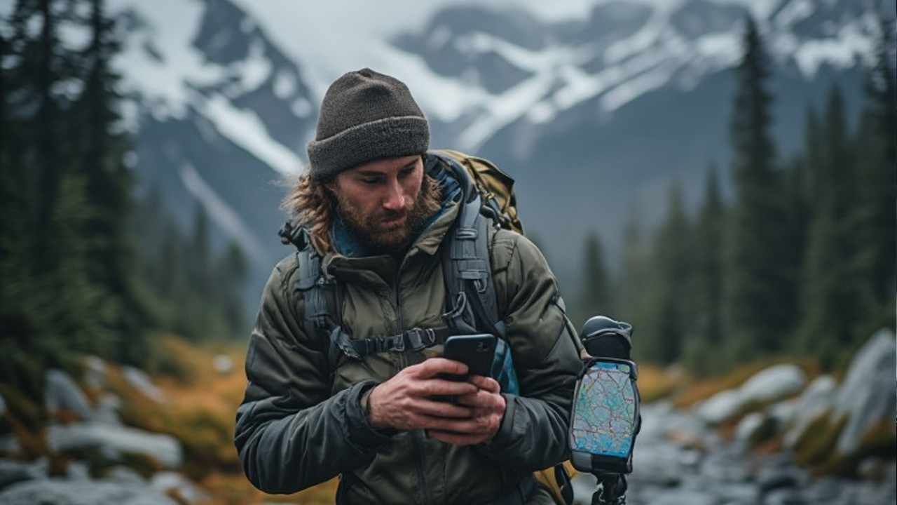
If you hunt remote country in Canada, the smartest setup is not one app or one device. It is a layered system: an offline mapping app for scouting and route tracking, a province-specific land or boundary layer for legal access, and a backup such as a handheld unit, satellite communicator, or printed map. The best tools are the ones that keep working when cell service disappears, weather changes fast, and you need to confirm where you are standing before first light.
That matters even more in Canada because remote access is never the same across the country. Alberta foothills, British Columbia timber, Manitoba wildlife management areas, Ontario Crown land, Newfoundland big-game zones, and Yukon game management subzones all demand different map habits. So instead of recycling the usual app roundup, this guide shows what to use, where it works best, what to download before you leave, and how to build a more reliable navigation stack by province and territory.
The Best Types of Mapping Tools for Canadian Remote Trips
| Tool type | Best for | Main strengths | Main weakness | Ideal user |
|---|---|---|---|---|
| Offline hunting app | General planning and navigation | Fast scouting, satellite imagery, topo layers, waypoint management | Phone battery and cold weather can be limiting | Most DIY hunters |
| Province-specific app | Local regulations and regional overlays | Better local detail, zone awareness, some regional ownership info | Interface may feel less polished | Hunters who stay in one province |
| Handheld GPS | Rugged navigation backup | Long battery life, durable buttons, reliable in rough weather | Smaller screens, slower map interaction | Backcountry, horseback, ATV, boat, and fly-in users |
| Satellite communicator | Safety and emergency contact | SOS, messaging, live tracking | Not a full scouting platform by itself | Solo or very remote travelers |
| Georeferenced PDF map app | Official map viewing offline | Great for imported government layers and custom map sheets | Less intuitive for full hunt planning | Hunters who rely on official base maps |
| Paper map and compass | Last-ditch fail-safe | No battery dependency | Slower, requires skill | Everyone should keep one as backup |
Digital maps and GPS devices are essential for navigating Canada’s vast wilderness without getting lost. Before heading out, review our backcountry survival guide to ensure you’re prepared for emergencies.
Best Known Tools for Remote Hunts in Canada
| Tool | Best use case | Biggest advantage | Watch-out | Best province fit |
|---|---|---|---|---|
| onX Hunt Canada | Broad remote planning across multiple provinces | Offline maps, route tracking, terrain tools, public/Crown land visibility | Private land depth can vary by area | Strong multi-province option |
| iHunter | Province-focused planning | Annual regulation updates, local zone overlays, strong Canadian orientation | Feature depth varies by province | Especially useful for province loyalists |
| Avenza | Offline use of georeferenced map PDFs | Excellent for official map sheets and custom imports | Less of an all-in-one scouting platform | Very helpful across Canada |
| BaseMap | Terrain-heavy planning and collaborative use | Fast offline maps, tracking, wind tools, rich map layer workflow | Canadian public-land detail may not match local-first tools everywhere | Better as part of a hybrid setup |
| Garmin GPSMAP / similar handheld | Backup navigation and rugged travel | Durable, reliable, battery-friendly, glove-friendly | Not as convenient for map study | Best for serious backcountry travel |
| Satellite communicator like inReach class devices | Safety and remote check-ins | SOS, messaging, tracking | Extra subscription cost | Best for northern or solo travel |
Bottom line: the strongest real-world setup is usually one phone app + one local layer solution + one backup device.
Best Tool Stack by Hunt Style
| Hunt style | Recommended setup | Why it works |
|---|---|---|
| Truck-based moose or deer trip | Offline app + vehicle charger + downloaded satellite/topo maps | Fast, simple, good enough if you stay near roads |
| Walk-in public-land trip | Offline app + province overlays + power bank | Best balance of legality and convenience |
| Backpack elk or mountain trip | Offline app + handheld GPS + satellite communicator | Covers battery risk, weather, and emergency needs |
| Fly-in northern trip | Handheld GPS + satellite communicator + offline app on airplane mode | Reduces failure points when you are truly remote |
| Water access bear or waterfowl trip | Offline app + marine-relevant waypoints + paper backup | Helps with launch points, marsh routes, and return navigation |
| Guided trip in unfamiliar country | Offline app shared with outfitter waypoints + backup communicator | Makes camp movement and recovery much easier |
Province-by-Province Mapping and GPS Guide for Remote Hunts in Canada
| Province / Territory | Terrain and access reality | Best map stack | Download before leaving | Best use case | Smart backup |
|---|---|---|---|---|---|
| Alberta | Foothills, timber, farm edge, Crown access complexity, WMU planning | onX or iHunter + offline topo/satellite + official recreation/public-land reference | WMUs, road access, public land recreation areas, creek crossings, camp pins | Elk, deer, moose, bear in mixed terrain | Handheld GPS or satellite communicator |
| British Columbia | Big vertical country, forestry roads, patchwork access, thick timber | onX + Avenza + downloaded satellite and 3D terrain | Road network, elevation layers, route tracks, valley access, avalanche-aware routes where relevant | Elk, mule deer, mountain trips, bear | Satellite communicator strongly recommended |
| Manitoba | Wetland edges, bush, WMAs, remote road grids, spotty service | iHunter + offline map app + Manitoba wildlife lands overlays | Wildlife management areas, refuge boundaries, access roads, marsh edges | Whitetail, black bear, waterfowl | Power bank and paper printout |
| New Brunswick | Dense forest, crown blocks, private land sensitivity, zone detail matters | iHunter or onX + Crown land references + hybrid imagery | Wildlife management zones, Crown land parcels, cut blocks, road junctions | Deer, bear, moose where lawful and applicable | Phone plus spare battery |
| Newfoundland and Labrador | Rugged, wet, weather shifts fast, management areas matter | Offline app + Avenza + downloaded management area maps | Big game management areas, stream crossings, bog routes, weather exit plan | Moose, bear, woodland travel | Handheld GPS works well here |
| Nova Scotia | Smaller parcels, crown land pockets, access changes quickly | iHunter + local public-land overlays + satellite view | Crown parcels, restricted areas, roads, parking pull-offs | Deer, bear, small game | Printed parcel screenshots |
| Ontario | Massive Crown land opportunities but rules vary by area | onX or iHunter + official atlas cross-check + topo/satellite | CLUPA-style area checks, WMUs, launch points, canoe routes, logging roads | Moose, deer, bear, back-lake access | Satellite communicator for remote north |
| Prince Edward Island | Limited public land footprint, smaller geography, clear parcel checking matters | Province atlas + simple offline app + saved pins | Public land atlas, access points, wetland edges, road pull-ins | Small game, waterfowl, local access planning | Power bank is usually enough |
| Quebec | Vast public territory, ZEC and controlled-use realities, French map references common | Avenza + iHunter/offline app + territory-specific planning | Public territory references, ZEC access, roads, fuel points, camp exits | Moose, bear, deer, northern trips | Handheld GPS for remote sectors |
| Saskatchewan | Prairie, bush fringe, agricultural Crown land, public parcel precision matters | iHunter + landowner/public layers + offline imagery | Agricultural Crown land viewer references, quarter sections, shelterbelts, access roads | Deer, bear, upland, mixed-farm country | Spare battery and printed grid notes |
| Northwest Territories | Huge distances, low connectivity, high consequences for mistakes | Handheld GPS + satellite communicator + offline phone maps | License area references, wildlife information layers, airstrip/camp points, weather exits | Dall sheep, caribou, moose, expedition travel | Full redundant navigation is best |
| Nunavut | Extreme remoteness, community and wildlife rules matter, no room for tech complacency | Handheld GPS + communicator + minimal phone app backup | Route tracks, camp points, emergency plans, local area restrictions | Arctic big-game travel and guided expeditions | Paper maps and route cards |
| Yukon | Mountain ranges, long river systems, game management subzones, remote travel risk | onX or Avenza + Yukon subzone maps + communicator | Game management areas, subzones, air or river access, emergency routes | Sheep, moose, caribou, mountain travel | Communicator plus handheld unit |
What Actually Matters in the Field
- A pretty interface is not enough. If an app looks good in town but performs poorly offline, it will frustrate you when you need it most.
- Legal clarity beats extra features. One clean public-land or boundary layer can save more trouble than ten fancy scouting filters.
- Cold weather changes everything. Phones drain fast in late-season conditions. Keep them close to your body and use airplane mode with offline layers active.
- Route tracking is underrated. Ask anyone who has tried to relocate a blood trail or a dark-timber camp in sleet. Breadcrumbs matter.
- The farther north you go, the less “app only” makes sense. In the territories, a backup device is not overkill. It is standard common sense.
- Province-specific data wins. Canada is not one uniform access system. A tool that feels perfect in Alberta may need support from a different atlas in Quebec or PEI.
The Best Setup by Budget
| Budget level | Recommended buy-in | Who it suits |
|---|---|---|
| Low cost | One solid offline app, one power bank, printed backup screenshots | Local and semi-remote users |
| Mid-range | Offline app, province-specific layer option, bigger battery pack, vehicle charger | Most DIY trips |
| High-value safety setup | Offline app, satellite communicator, weatherproof battery plan | Solo and deeper backcountry use |
| Premium setup | Offline app, handheld GPS, communicator, map prints, spare cables, hard-case battery kit | Multi-day, fly-in, or mountain trips |
What to Download Before You Lose Signal
- Primary offline map area at the highest practical resolution.
- Secondary wider-area map around your main block in case you need to reroute.
- Satellite imagery for cutlines, burns, clearings, marsh edges, and hidden road traces.
- Topo layers for elevation, drainages, saddles, benches, and slope shape.
- Boundary layers for public access, private limits, lease areas, or regulated zones.
- Waypoints for truck, camp, cache, glassing points, blinds, stands, boat launches, strips, and recovery sites.
- Shared route files if you are traveling with partners.
- Weather checkpoints and exit plans.
- Charging plan, including cords that actually fit the devices you packed.
- Paper fallback, even if it is only a few printed screenshots in a zip bag.
A Better Canadian Workflow for Map Prep
| Step | What to do | Why it helps |
|---|---|---|
| 1 | Pick your primary app | Avoid juggling too many interfaces in the field |
| 2 | Cross-check legal access with official regional data | Reduces trespass and zone errors |
| 3 | Save multiple offline layers | One layer never shows everything |
| 4 | Build a waypoint folder by day or zone | Keeps the map uncluttered |
| 5 | Mark entry and exit options | Critical when roads wash out or gates close |
| 6 | Share your plan with a partner | Improves coordination and safety |
| 7 | Test offline mode at home | Prevents nasty surprises in the bush |
| 8 | Pack one true backup | Because batteries, screens, and weather all fail eventually |
For official land-reference checking, the Ontario Crown Land Use Policy Atlas is a good example of the kind of government layer serious hunters should cross-check, and Avenza Maps is still very useful when you want georeferenced map PDFs offline instead of relying only on app overlays.
If Alberta is one of your main destinations, it also makes sense to pair your navigation prep with this Alberta hunting seasons guide before you finalize waypoints and access plans.
Common Mistakes That Cost Time, Opportunity, or Worse
| Mistake | What usually happens | Better move |
|---|---|---|
| Relying on live signal | Blank map tiles or slow loading once you are remote | Download full offline packs before departure |
| Saving only one tiny map area | You step outside coverage and lose context | Save a detailed core area and a wider backup layer |
| Ignoring battery management | Phone dies halfway through the day | Use airplane mode, low brightness, and a power bank |
| Using no backup at all | One broken screen ends your navigation plan | Bring a handheld unit, communicator, or paper map |
| Forgetting access law differences | You wander onto the wrong parcel or restricted area | Cross-check boundaries and season zones in advance |
| Marking too many random pins | Your map becomes cluttered and hard to read | Use folders by species, trip, or day |
| Not testing the system at home | You discover problems after you unload the ATV or boat | Run a full offline check before leaving |
The Best Overall Recommendation by Region
- Best all-around western setup: onX + Avenza + backup communicator
- Best prairie setup: iHunter + landowner/public layers + offline imagery
- Best Ontario and eastern bush setup: onX or iHunter + official parcel/zone check + spare power
- Best northern expedition setup: handheld GPS + satellite communicator + phone maps only as support
- Best budget-friendly setup: one good offline app, careful downloads, printed parcel notes, and disciplined battery use
Final Take
The best mapping and GPS tools for remote hunts in Canada are the ones that reduce uncertainty. You need to know where you are, whether you can legally be there, how to get out, and what happens if your primary device fails. That is the real buying standard. Not hype. Not ad copy. Not brand loyalty.
If you want the simple answer, here it is: use a hybrid setup. Start with an offline map app, add the most relevant provincial or territorial reference layer, and carry a backup that does not depend on perfect battery life. That approach works better than app-only optimism, and it works across Alberta, BC, Manitoba, New Brunswick, Newfoundland and Labrador, Nova Scotia, Ontario, PEI, Quebec, Saskatchewan, Northwest Territories, Nunavut, and Yukon.
FAQs
Do I still need a handheld unit if my phone has offline maps?
Not always, but for deep backcountry travel, mountain routes, fly-ins, or northern trips, a handheld unit is still a smart backup. Phones are excellent planning tools. Dedicated devices are better at surviving cold, rain, drops, and long days.
Which app is best for public-land access in Canada?
There is no single winner everywhere. onX is strong for broad multi-province use, iHunter is very relevant for province-specific planning, and Avenza is excellent when you want official georeferenced map sheets offline. In practice, the best answer is often a combination.
What should I prioritize: satellite imagery or topo maps?
Download both. Satellite imagery helps you see cuts, burns, marsh edges, trails, and openings. Topo maps help you understand elevation, benches, saddles, drainages, and route effort. One without the other leaves gaps.
Is a satellite communicator worth the money?
For solo travel, mountain country, northern access, or anywhere far from quick help, yes. It is one of the highest-value safety purchases you can make. It also adds peace of mind for family or partners waiting back home.
Are province-specific layers really necessary?
Usually, yes. Canada is not one unified land-access system. Zone rules, Crown land references, wildlife management overlays, and map naming conventions change by region. Generic maps are useful, but local layers prevent expensive mistakes.
What is the best low-cost setup for someone starting out?
A reliable offline app, a fully charged power bank, good download discipline, and a printed backup map will cover a lot of situations. You do not need the most expensive setup on day one. You do need a tested one.

- Canada Hunting Youth Regulations 2026–2027: Age Requirements, Licences & Hunter Rules by Province - October 10, 2026
- Where to Hunt in Canada: Provinces, Species & Planning Guide - October 10, 2026
- Hunting Tags in Canada: Validation, Attachment and Transport Rules Every Hunter Must Know - October 5, 2026